What is it about?
CityAir is a smartphone application (App) for the public to express their perception of the outdoor air quality at their location. It allows users to collect and display individual perceptions of air quality, irrespective of where they are in the world. It also allows users to express their view on which source is the main contributor to the poor conditions, if the air quality is not perceived as good. 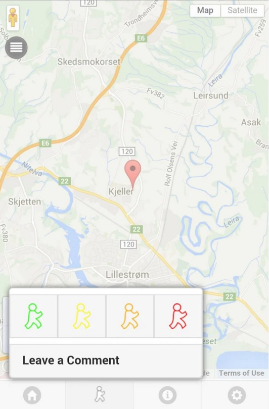
CityAir gives the user the possibility to rate the air quality in their immediate surrounding by using a code of four colours:
Green – very good air quality;
Yellow – good air quality;
Orange – poor air quality;
Red – very poor air quality.
In CityAir the user can also indicate the assumed source of the air pollution and write a comment
How to use it?
When the user has access to network and GPS signals, the App will display a map and mark the users’ current position. When the user moves into another area, the home-button will re-position the marker onto the correct place on the map.
The user can add a perception marker for the current air quality, and suggest a pollution source or leave a comment. When the preferred network is available (chosen by the user), the App will upload the information provided by the user into the CITI-SENSE platform.
Before the first use of the App, the user can select a preferred language from a list. S/he will be also asked personal information (gender, year of birth and education) for statistical purposes.
Where to look for data?
The user can choose to download other users’ perceptions reported through CityAir for the same day, the last week or the last month, directly into the CityAir App on their smartphone.
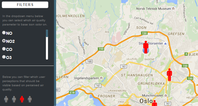
CITI-SENSE Data Web Page http://srv.dunavnet.eu/new/citisense/OutdoorDataPortal allows viewing the collected perceptions reported by all contributing users. The web page allows also for viewing the reported perceptions from a specific location, to only get the last observations, or observations made in a specific time period.
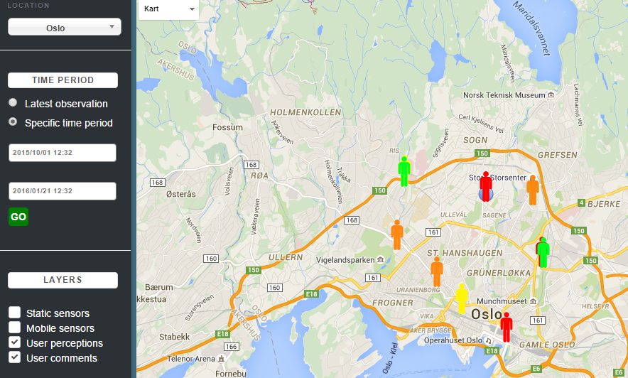
All perceptions can be found under the User perceptions and User comments layers.
The user can also choose to filter the markers on the map according to perceived air quality (the pollution components in the picture below do not apply).